Anyone who has read my past blog posts knows that one of my
biggest priorities with this project is making information accessible to
researchers. This week I came across a map of Ontario from the late nineteenth
century that intrigued me because I could imagine researchers using this map
to look at the development of Ontario, CA.
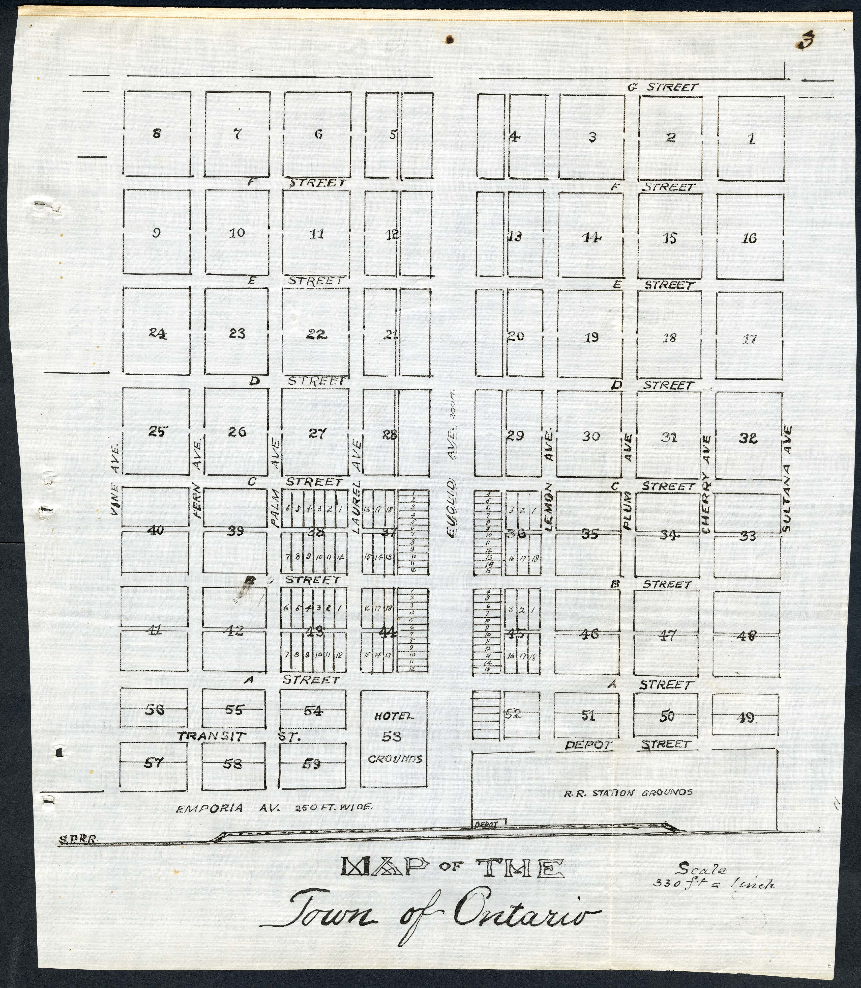
This map was made in 1883 and was found in a series of documents
pertaining to land and title companies in San Bernardino County during the late
nineteenth century.
Although Ontario has changed a lot in the last 134 years,
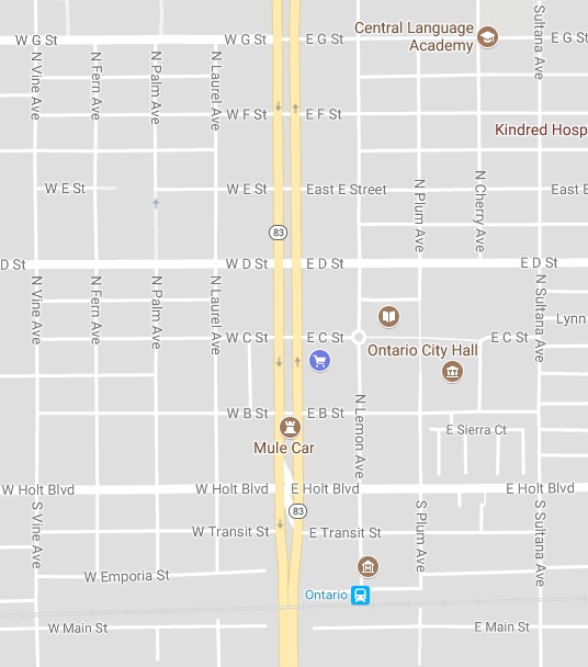
some of the streets labeled on the map still exist today. I couldn’t resist
looking up this area of Ontario on Google Maps to see how things have changed.
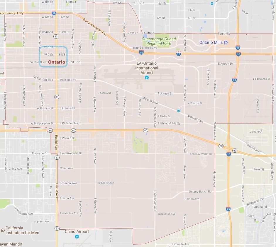
What is depicted on the map from 1883 is only a portion of
the Ontario of today. This is an image of the entirety of Ontario, CA, with a
blue box indicating the scope of the nineteenth century map.
Maps are some of the most interesting features I have come across during my time here, especially when I compare them to maps of today. Maps represent tangible evidence of how a place has changed throughout history and it gives a visually striking impression on how times have changed.
Normal
0
false
false
false
EN-US
X-NONE
X-NONE
/* Style Definitions */
table.MsoNormalTable
{mso-style-name:”Table Normal”;
mso-tstyle-rowband-size:0;
mso-tstyle-colband-size:0;
mso-style-noshow:yes;
mso-style-priority:99;
mso-style-parent:””;
mso-padding-alt:0in 5.4pt 0in 5.4pt;
mso-para-margin-top:0in;
mso-para-margin-right:0in;
mso-para-margin-bottom:10.0pt;
mso-para-margin-left:0in;
line-height:115%;
mso-pagination:widow-orphan;
font-size:11.0pt;
font-family:”Calibri”,”sans-serif”;
mso-ascii-font-family:Calibri;
mso-ascii-theme-font:minor-latin;
mso-hansi-font-family:Calibri;
mso-hansi-theme-font:minor-latin;}