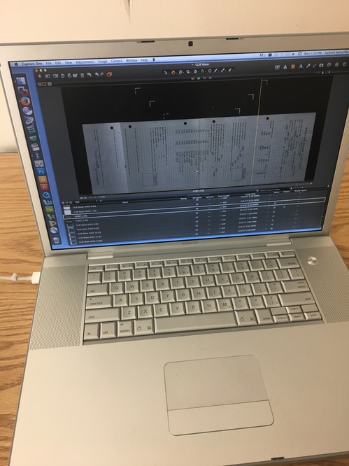
 For the past few weeks I have scanned a few reports that included oversized documents. These oversized documents require us to go downstairs and utilize the camera room. Our camera room is equipped with a professional grade Hasselblad camera, two oversized lights, an oversized projector that you can mount the camera on as well as a tripod, a stepping stool, a white board with multiple magnets and a value swatch sheet to help with the white balance of the photo, a few tables and cords and a macintosh laptop to help process and save the photos. We use Capture One to process and adjust the white balance of the photo. After we adjust the white balance and make sure the item in the photo is properly aligned with the vertical and horizontal grid lines, we process the photo for the output folder and from there we open up the image in photoshop and crop it accordingly. I like to name the tif file after the document processing number (according to its original report and pdf) and the Aeon transaction number that correlates with the online request for the primary source.
The hardest part about processing oversized items is making sure that the item in the photograph properly aligns with the grid lines in Capture One. So many factors can affect the alignment of the item prior to it showing up on Capture One. Such as, the camera could be tilted or crooked on the oversized projector or the tripod, the item could look completely straight and aligned to you but show up at a 57 degree angle once the image is processed, and a plethora of other random things. When you take your first shot, you want to cross 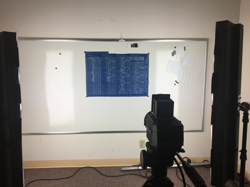 your fingers and hope that it comes out properly aligned on Capture One. However, if your hopes were not acknowledged and it came out crooked on Capture One, you have to do a bit of mental geometry in order to find the right angle that would match up the item with the grid lines. For example, the photograph on the right is of a blueprint that we were in the process of photographing. Does it look properly aligned to you? Well according to Capture One, we were off by 20 degrees. Doesn’t really sound like a lot but it looks like a huge difference. Aside from how close you have to pay attention to details, the camera room is really interesting to work in.
Titular Index
Greetings, California water resources enthusiasts! This week I scanned Bernard A. Etcheverry and H. L. Haehl’s “Report on Conservation of Controlled Flood Water of San Gabriel River (With Index to Spreading Studies)” (1936). That the index was noteworthy enough to include in the title intrigued me (I am easily intrigued). It lists related documents from the Los Angeles County Flood Control District, with a “distinguishing letter, a Roman file number and an Arabic exhibit number” for each entry.
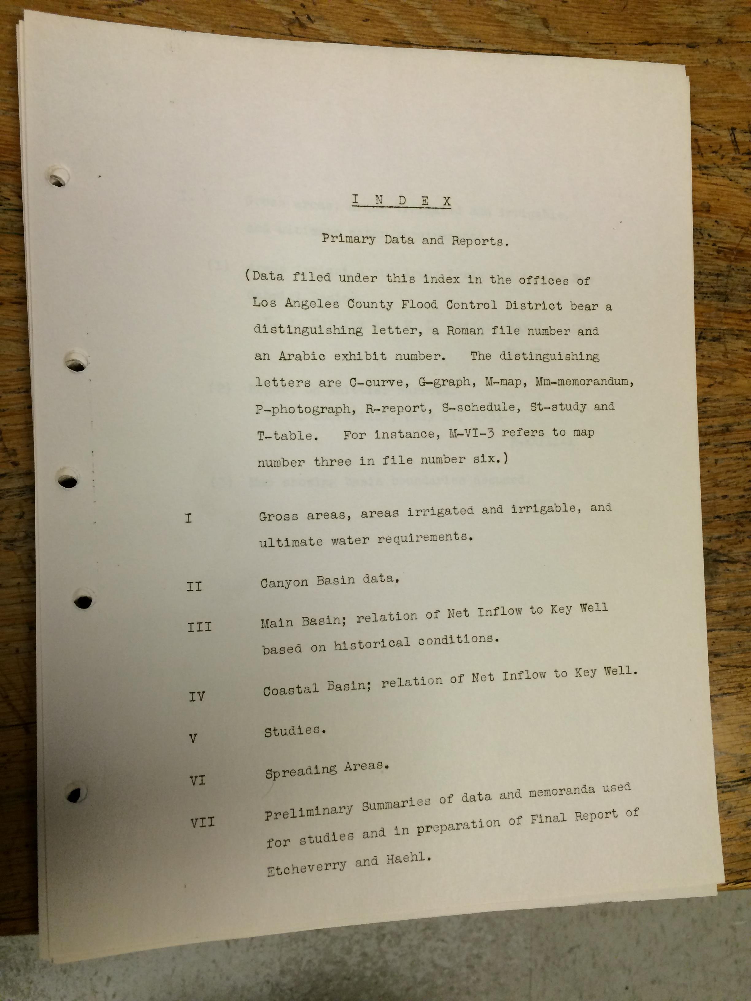
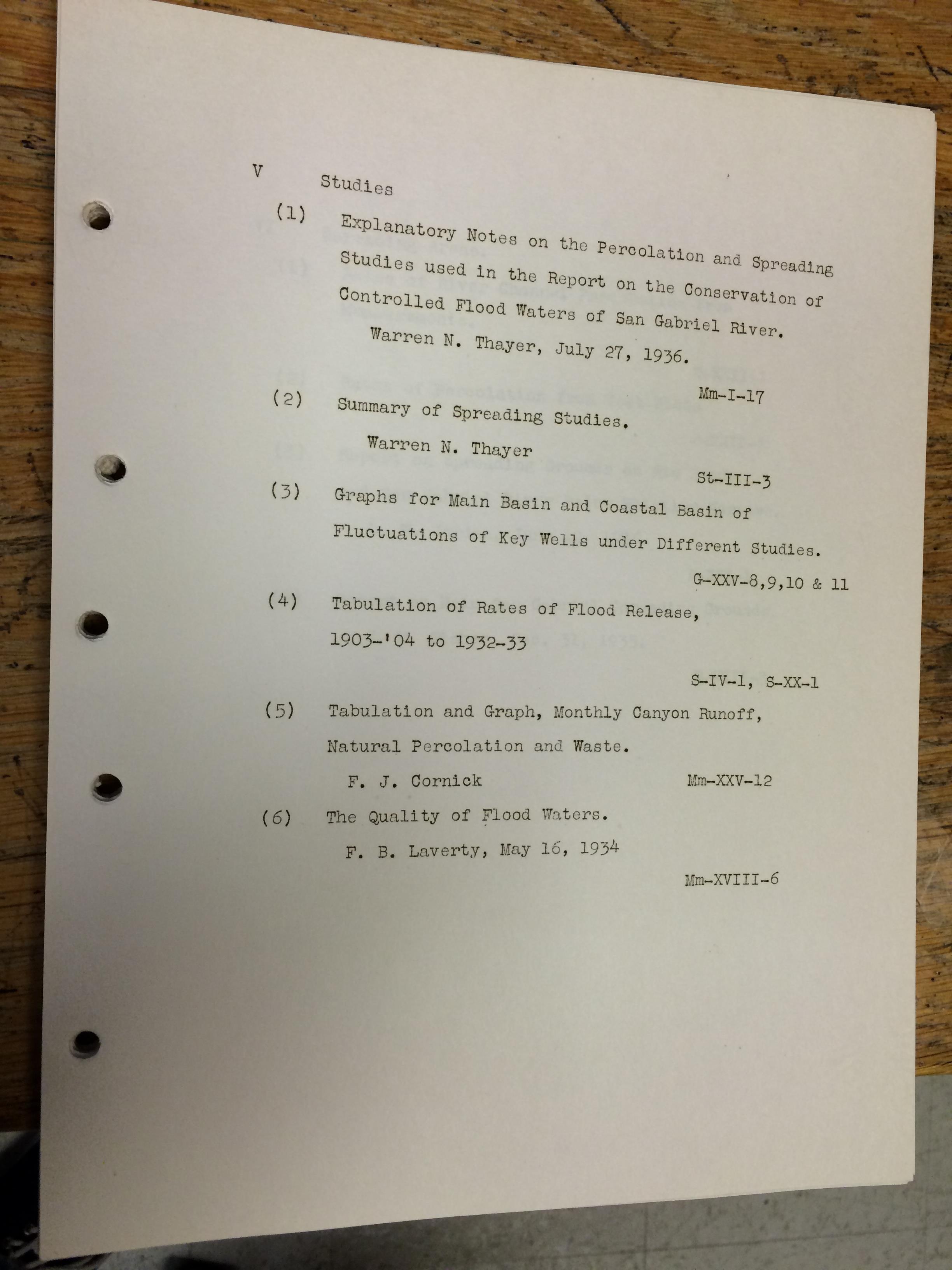
Whether a titular index was standard procedure or rarity in the pre-Internet days of government reports, I know not. The thoroughness of the authors’ index-craft is, to be sure, impressive. As I digitize subsequent documents I will be sure to keep an eye out for more occurrences of this mysterious phenomenon.
See you next week.
Blog Entry 002; Blueprints and Tracking Down Sources
One of the cool things about digitizing the Water Resources Collection is reviewing the blueprints. Although we are not in the metadata stage right now, scanning the smaller blueprints is really interesting. There is not as much time spent on the larger blueprints because we have to put them on hold for photography or the overhead scanner in the Special Collections Reading Room. However, these blueprints highlight irrigation systems and other notable rivers such as the Colorado River and the San Luis Rey River.
The reports and correspondence letters to different organizations and professors can range from 13 pages to 75 pages. The more bulky reports typically have 3-5 blueprints inside. And the blueprints are either cutouts of larger blueprints or the whole entire sheet folded strategically so that it can fit into the portfolio. Varying between an all-blue or an all-white background, the blueprints either have white or blue ink (respectively).
Although I love my work station, I have a favorite scanner that I like to use for my portfolio covers and blueprints. It is a flat bed scanner that is connected to the desktop work station opposite me and its resolution wins my heart. Cropping and adjusting the histogram scale of the blueprints is much more easier with a flatbed scanner.
Another interesting thing about working with these resources is properly tracking them down to submit requests for them. For example, when most of my materials are digitized from my prior shift, I notify my supervisor and she gives me a list of items to submit Aeon requests for. I like to do this part at the beginning of my shift because it could be tricky sometimes: Most of the time you can type in the full title of the item and find it in the library catalog, but 2 times out of 5 you are going to have to pick out keywords from the title in order to find them in the online catalog. For example, it took me 8 different search forms to find a correspondence letter. I searched by the title, call number, the person the letter was addressed to, the name of the river it mentioned, the date of the letter, partial call number and given person, and partial call number and name of the river. Finally I just searched the river and restricted the search to only special collections and sorted the results alphabetically. The search process can be tricky because the titles of the documents are long. With primary resources, it is common to have resources with long titles because there has to be attention to detail and a lot of keywords are vital and cannot be leftout.
Therefore, whenever I tell someone that I am digitizing the California water documents and they reply back “Isn’t that boring?”, I have no choice but to tell them that it is much more complicated than it sounds.
Much Abutment About Nothing
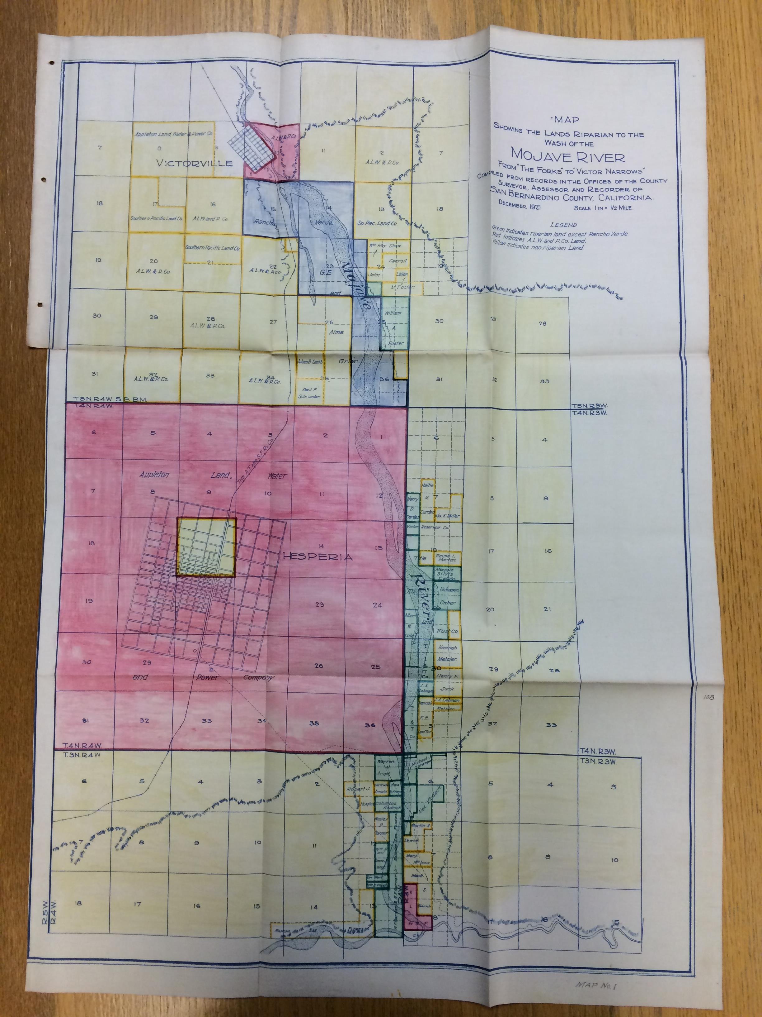
The scanning of Frederick Cecil Finkle’s “Report on Victor Valley Irrigation District, San Bernardino County, California” (1923) mentioned at the end of last week’s post continues on, ever on, like riparian lands extending to the wash of the Mojave River. The report includes maps and blueprints that are too large for the CCEPS scanners to accommodate, necessitating a visit to the library’s digital photography room in the near future.
In the meantime, here are some photographs from Finkle’s report depicting Mojave River dam sites. Enjoy!
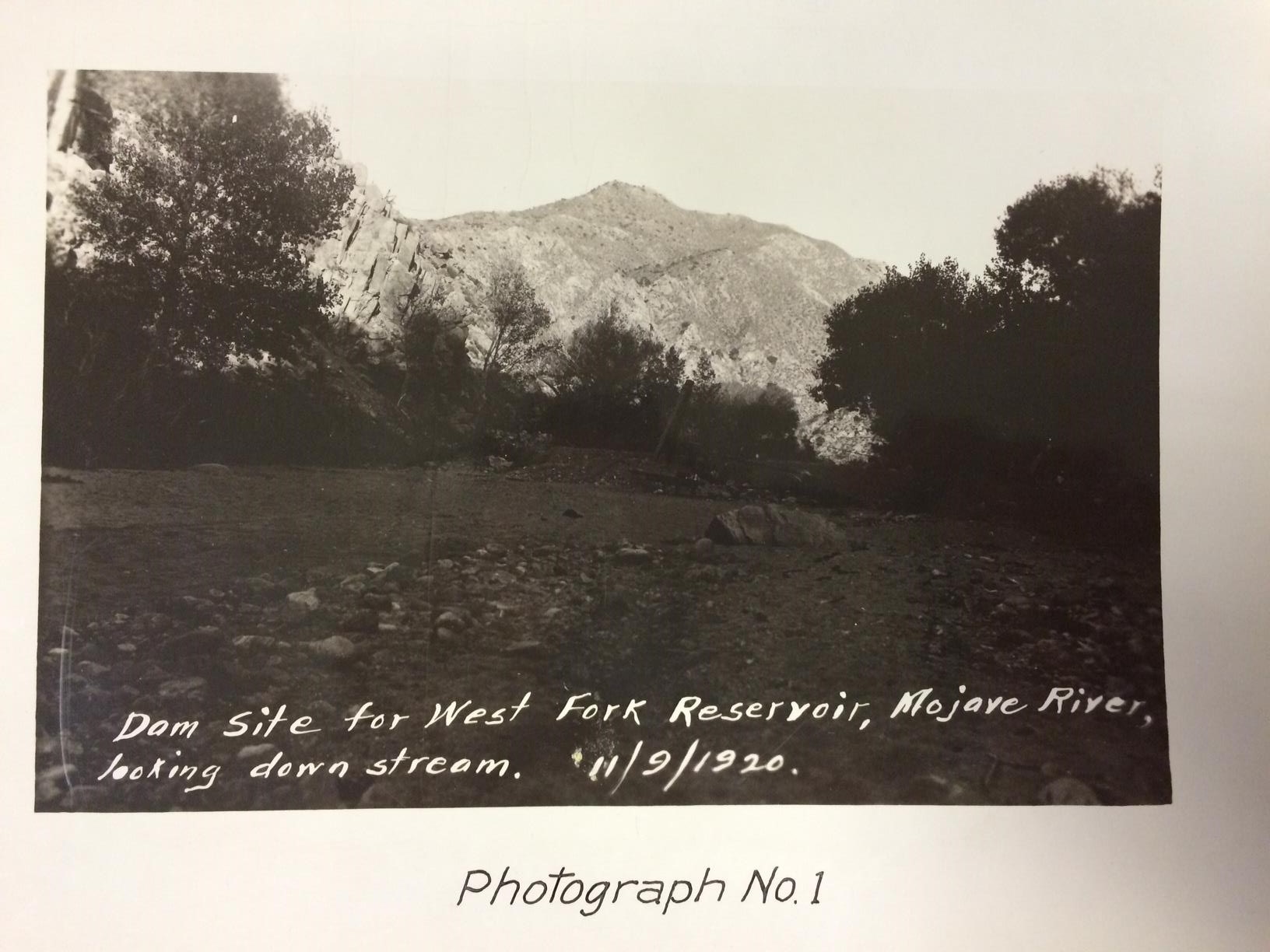
Dam site for West Fork Reservoir, Mojave River, looking down stream, November 9, 1920.
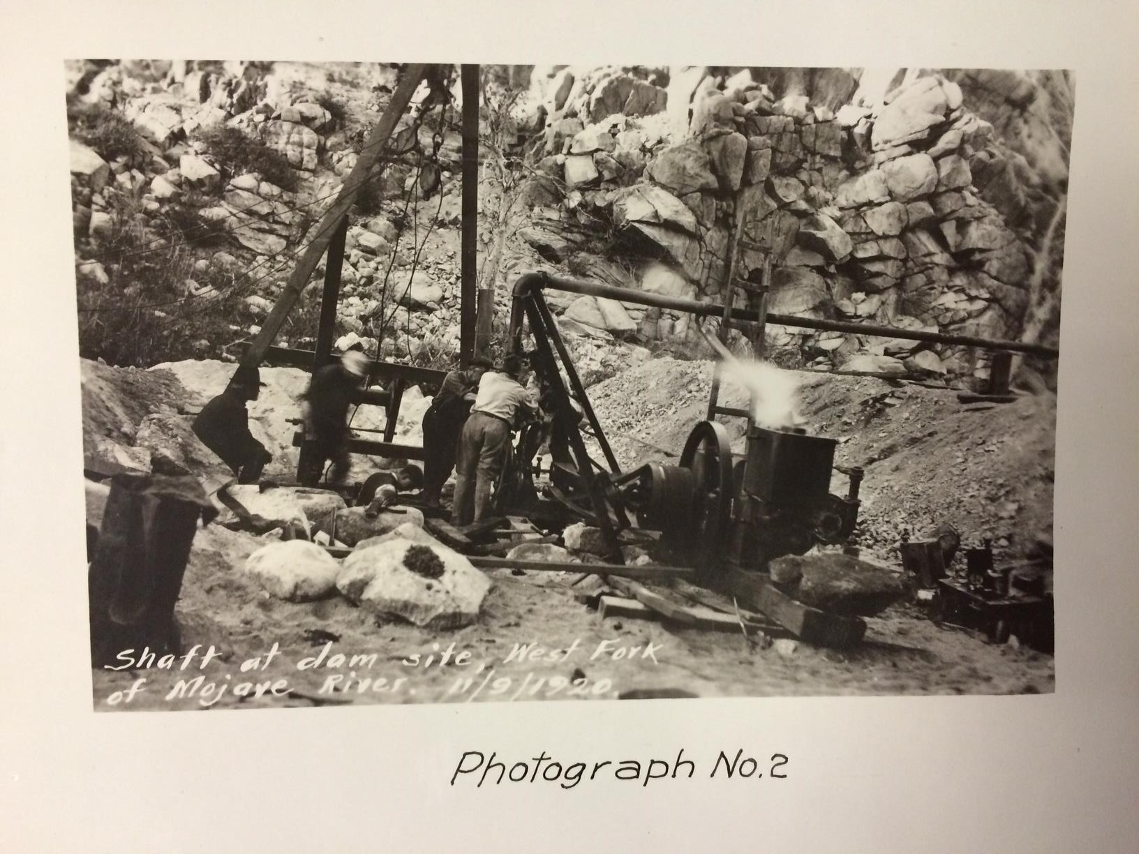
Shaft at dam site, West Fork of Mojave River, November 9, 1920.
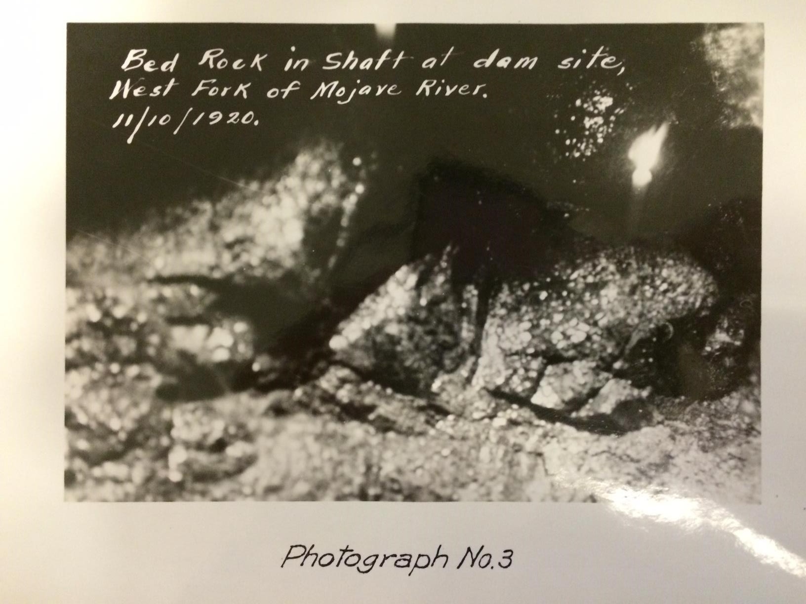
Bed rock in shaft at dam site, West Fork of Mojave River, November 10, 1920.
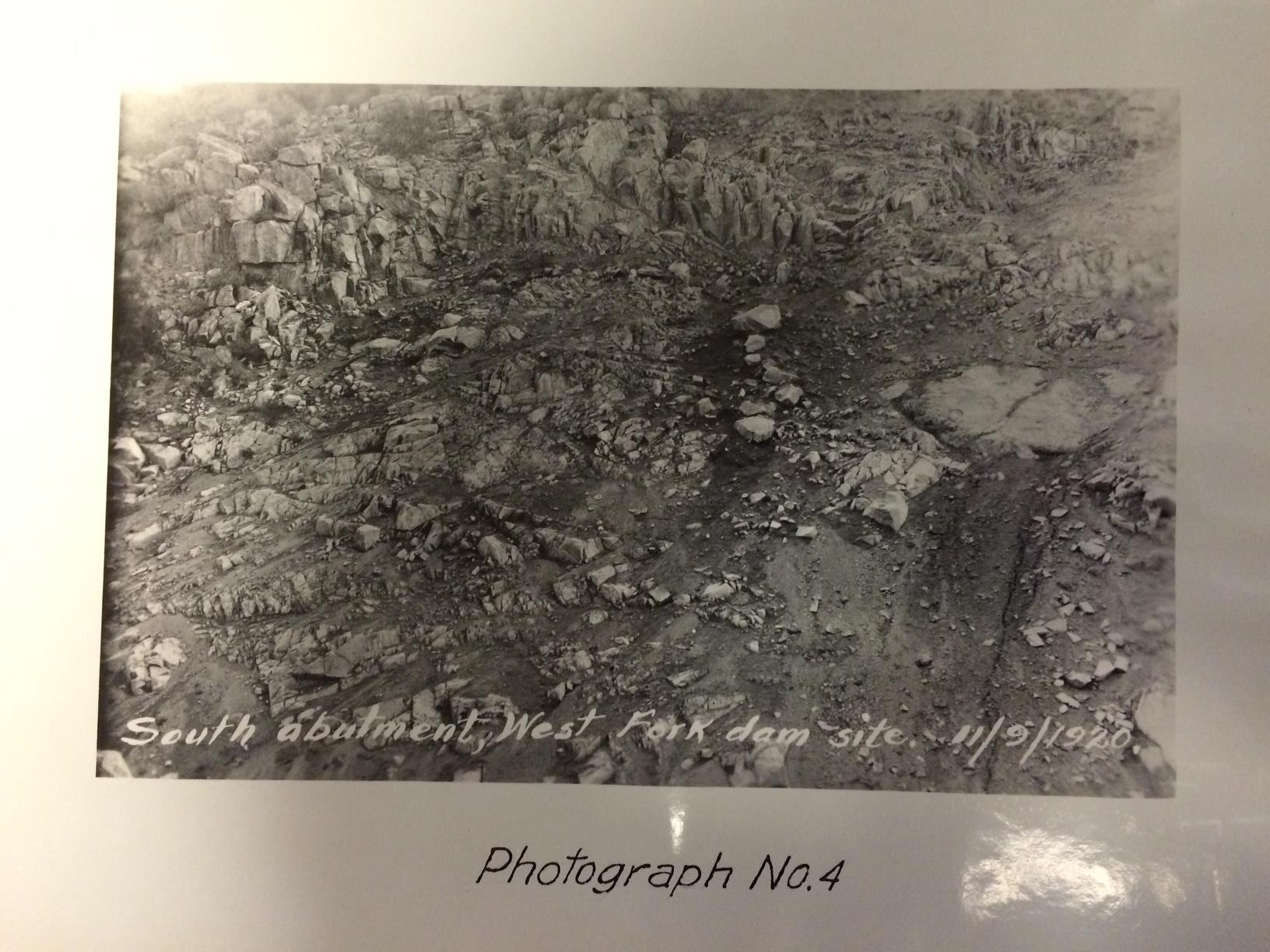
South abutment, West Fork dam site, November 9, 1920.
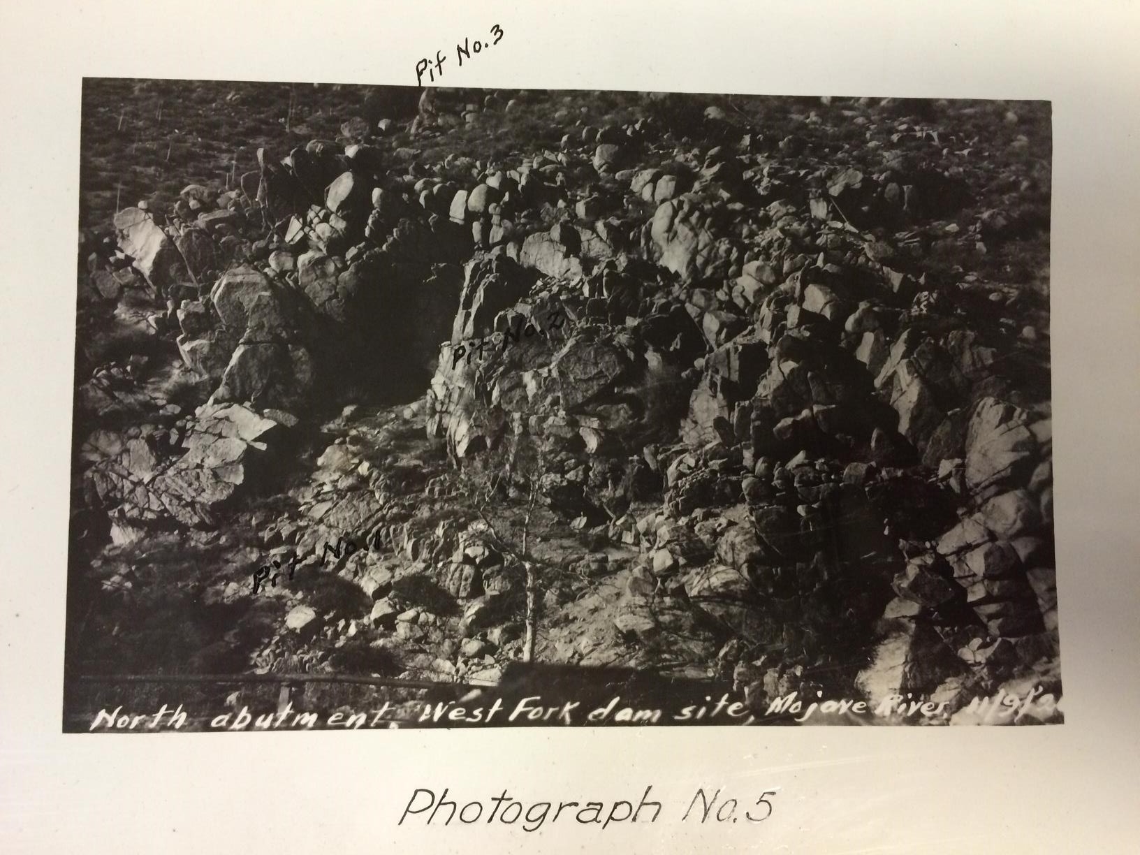
North abutment, West Fork dam site, Mojave River.
Blog Entry 001; Transparent Paper
Although one of the vital first steps of digital archiving is tedious it also builds up the excitement for the metadata stage. For the past week, I have been scanning reports and correspondence letters of California water systems and planning resources. Along with carefully unbinding reports and time tracking the scanning process, the biggest challenge that I have encountered is the complexity of scanning typed transparent paper.
Each scan has an adjusted histogram light contrast scale and helps create the sharpness of the digital document. Since the transparent paper is so sensitive to the scanner’s screen and light, any slight adjustment on the histogram scale will make the digital version of the document look too washed out or too blurry. Playing around with the histogram scale, I had to find the best way to create a clear digital copy that stayed true to the document’s original form and also proved to have the sharpest contrast. Below are images of the different adjustments of the histogram scale.


And Now for Something Completely Different
Hi, folks! Welcome to a new and exciting CCEPS project, Digitizing Southern California Water Resources! Thanks to a grant from the Council on Library and Information Resources (CLIR) awarded to six collaborating institutions,* student workers at the Claremont Colleges Library will digitize documents relating to California water (from what I saw of the holdings, reports from the California Department of Water Resources will feature prominently) and upload them to the Claremont Colleges Digital Library (CCDL). Along the way we’ll provide weekly updates to this blog with tales and images from our many adventures in archiving. Let us begin!
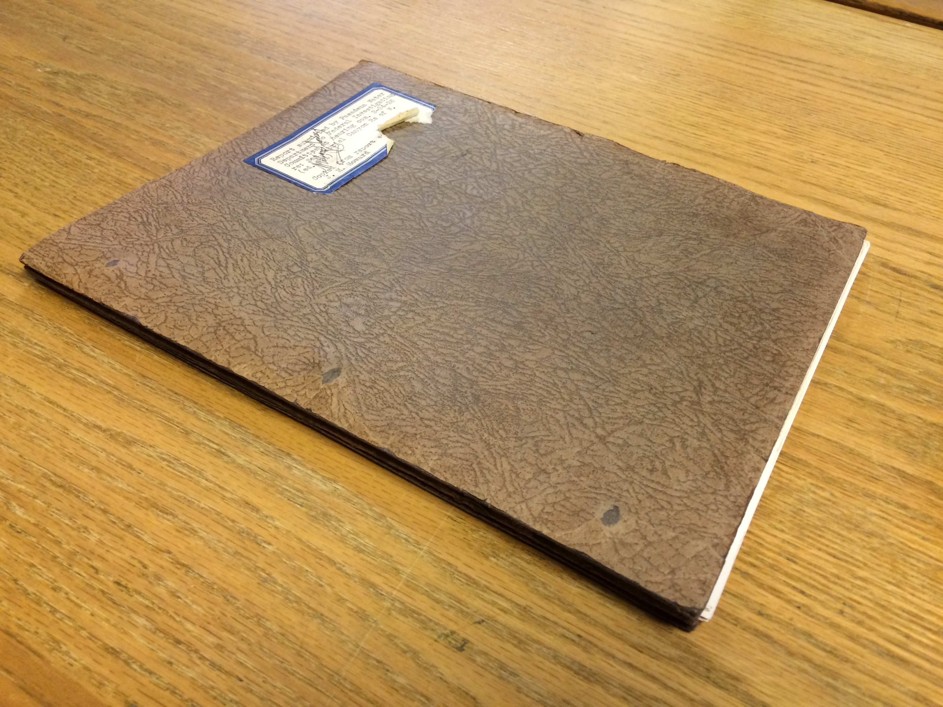
Last week I started with a 1926 report by the Pasadena Water Department’s Chief Engineer, Samuel B. Morris, titled, “Report submitted by Pasadena Water Department to Federal Investigating Committee at hearing com. 2-24-26 re: San Gabriel Canyon Rs of W.”

According to Morris, the purpose of the report is to “present Pasadena’s water supply needs, proposed San Gabriel River domestic water supply project, and suggestions of methods to permit the fullest realization of the objects and aims of both the City of Pasadena and the Los Angeles County Flood Control District with the greatest economy and speed.”
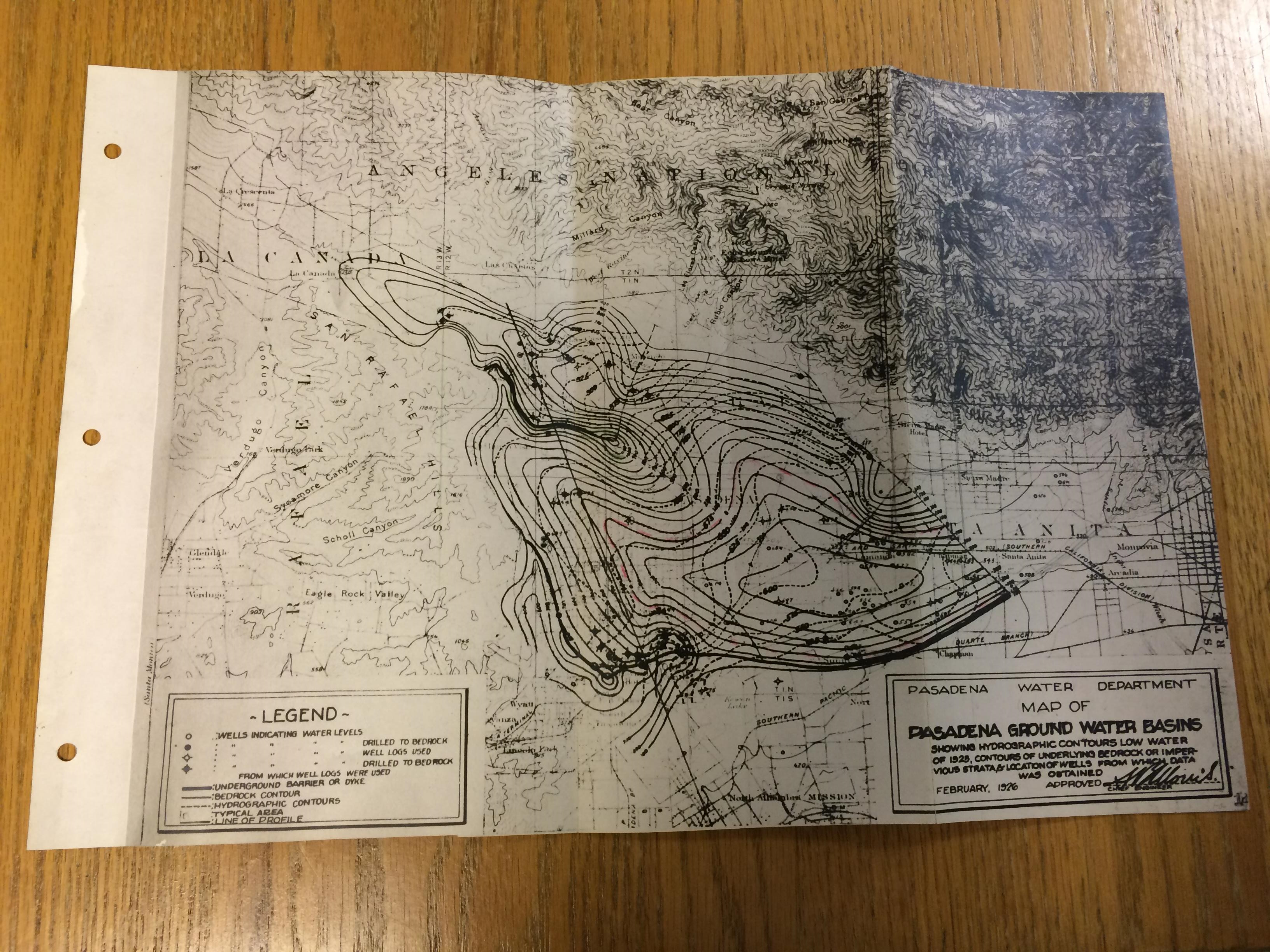
He rounds out the report with an assortment of graphs visualizing trends and probabilities, as well as this nifty map of Pasadena ground water basins:
We’re not uploading to the CCDL’s Water Documents page just yet, but we’ll let you know when we do.
In the meantime I’m scanning a report on the Victor Valley Irrigation District. Stay tuned!
-Myles
*The collaborating institutions are: The Claremont Colleges Library, the A.K. Smiley Public Library, California State University Northridge Oviatt Library, California State University San Bernardino Water Resources Institute, the National Archives and Records Administration at Riverside, the Ontario City Library, and the Upland Public Library. Whew.